 |
Tyler is located at 32°20′3″N 95°18′0″W Elevation 544' |
Getting Around Tyler
Tyler is located in the geographical area of Upper East Texas, about half-way between Dallas and Shreveport, and just south of the Interstate I-20 corridor. Tyler is the county seat of Smith County, occupies an area of about 50 square miles, and is at an official altitude of 544 feet above sea level.
 |
The Street and Highway System in Tyler
Tyler has an excellent, solid transportation infrastructure which equates to short, easy commuting times and experiences with inner Loop 323 and the new Toll Loop 49. A regional bus system and Pounds Regional Airport provide additional transportation options within and outside of the city.
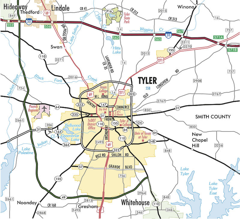
- U.S. Highway 69 (Broadway Avenue) is the major north-south route through the city, from Lindale south through Tyler down to Bullard and Jacksonville. It is known as North Broadway north of the downtown square, and South Broadway heading south from the square towards Jacksonville.
- Loop 323 functions as a 19.7 mile, ground-level 4-6 lane inner-loop, while the new Toll Loop 49 will provide a large outer-loop at its completion.
- Texas Highway 31 is a major east-west corridor, connecting with Kilgore to the east and Chandler and Athens to the west.
- Texas Highway 64 provides a more northwest-southeast alignment, connecting with Arp and Henderson to the east and Canton to the west.
- Highway 110 to the southeast is also known as "Troup Highway".
- Highway 155 runs to the southwest through Noonday and Coffee City ... also known as the "Frankston Highway".
- U.S. Highway 271 begins in north Tyler and connects with Gladewater and Gilmer to the northeast. Highway 271 provides the shortest access to I-20 when heading east to Longview and Shreveport.
- Farm-to-Market (FM) 2493 travels to Gresham, Flint and Bullard and is also known as "Old Jacksonville Highway".
- Grande Boulevard is a significant east-west route, running from Troup Highway westward, intersecting with Paluxy Drive, South Broadway Avenue and Old Jacksonville Highway, and ending as Texas Highway 57 at Texas Highway 155.
- Paluxy Drive (FM 756) begins near the Green Acres Shopping Center and moves south past Loop 323, Grande Boulevard, and Toll 49. It then crosses FM 346 and continues south outside of Tyler, ending at FM 344 in Walnut Grove.
- Highway 14 runs north from Tyler, past John Soules Food, crosses I-20 and provides access to Tyler State Park.
- Spur 248 (University Boulevard) extends from SSE Loop 323 to the east, and provides access to the University of Texas - Tyler.
- Spur 364 runs from SW Loop 323 and extends to Texas Highway 31 West, and provides access to Lindsey Park.
- FM 346 runs eastward from Flint, passes U.S.Highway 69, Highway 110 in Whitehouse and continues past Lake Tyler.
- Toll Loop 49 is available for those heading westbound to Dallas and beyond from Tyler. Toll 49 currently runs from near Whitehouse westward, crosses I-20, and ends at U.S. 69 between Lindale and Mineola, a total length of 32 miles.
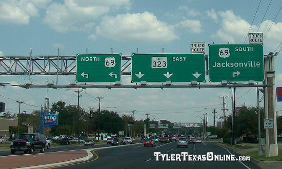
Tyler Texas Area Highway Map from TxDOT (click the map for a larger image at the TxDOT Website) The intersection of Loop 323 with South Broadway Avenue (U.S. Highway 69) |
More about Toll Loop 49
Texas Loop 49, being built in stages, connects with I-20 near Lindale, providing an additional route from Tyler to this major Interstate route. It also alleviates traffic volumes on other Tyler traffic arteries such as Loop 323 and U.S. 69.
Initial segments were built to the south and west of Tyler, as two-lane limited-access roadways, but right-of-ways are designed for an eventual four-lane highway.
Today, in 2025, six segments of the loop are completed, including the Lindale Relief Route ending at U.S. 69 between Lindale and Mineola. Eventually, Toll Loop 49 will also connect to I-20 east of Tyler, at some point still under study.
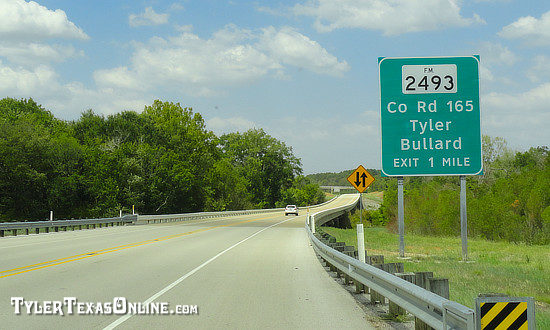 Loop 49 South of Tyler at FM2493 (Staff Photo) |
 Loop 49 Overpass (Staff Photo) |
Interactive Map of Tyler Texas (courtesy of Google Maps)
Tyler Transit System
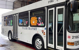
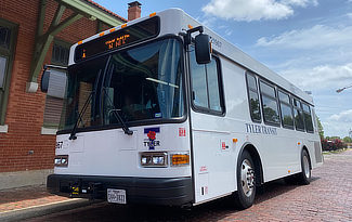
The Tyler Transit municipal bus system provides regular service throughout the city. Visit the Tyler Transit website for routes, hours, maps, ticket/passes, and other pertinent transit information, or phone 903.533.8057.
Several routes are available, including the North Tyler Route, South Tyler Route, Broadway Express, Front & Erwin Route, Campus Connector and Medical District Route.
Tyler Transit is housed in the renovated Cotton Belt Railroad Depot downtown at 210 East Oakwood Street.
 |
|||
|
East Texas Intercity Bus Transportation
GoBus provides transportation between 14 counties and many cities in East Texas. Phone 800.590.3371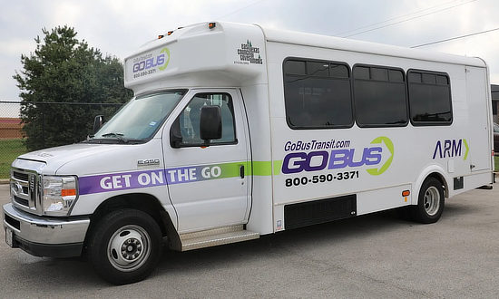 |
Taxi Services in Tyler
Several transportation companies offer taxi service in Tyler, including Tyler Cab. Ride-sharing services are also available, including Uber and Lyft.
Also in Tyler, Rose City Chauffeur offers a range of luxury car services, including airport transfers, business travel, hourly/as directed, weddings and special occasion travel options. Its fleet includes a sleek and stylish Mercedes-Benz premium sedan.
Old Jacksonville Highway Corridor (FM 2493)
Old Jacksonville Highway is a major north-south artery in Tyler. It begins at South Broadway Avenue near the Bergfeld Center, intersects with Loop 323 and Toll 49, and continues south to Gresham, Flint and Bullard.
Shown below is a recent scene along Old Jacksonville Highway.
 |
Cumberland Road Extension
The new section of Cumberland Road between South Broadway Avenue and Old Jacksonville Highway opened in 2016. This stretch of road provides an additional 4-lane east-west corridor in Tyler. Along the road are the new Tyler Police Department substation, Faulkner Park, Jack Elementary School, a new Tyler firestation and the Legacy Bend development.
The roadway also includes a hike-and-bike trail that varies between 5 and 10 feet in width, depending on the section. Shown below is a recent scene along the West Cumberland Road extension.
 |
Getting Around Tyler by Bike
The Tyler area offers a number of recreational trails and parks for biking, located in the center of the city and in outlying areas. The elevation in Smith County ranges from 300 to 600 feet, providing biking challenges even for the most experienced riders. Even in the City of Tyler, bicyclists will find hills and elevation changes which provide exciting biking rides, as well as flat trails for more relaxing times.
Access to the trails such as the Rudman-South Tyler Trails and Legacy Trails, and parking, is available at numerous locations.
City of Tyler Bicycle Information, Maps & the Bike Stripes Project - The project identifies 11 bicycle lane routes and a centralized hub near the downtown area. The work includes painting bicycle lanes and placing designated signage along the existing roadways. An overview of all the routes is available with plans for the new "spokes."
![]()
About Tyler Bicycle Trails, Routes, & Bike Shops
 Image courtesy of the Tyler Bicycle Club |
Important Tyler Area Transportation Links
|
