 |
Texas Toll 49 in the Tyler Area
Texas Toll 49 was designed and built to move automobiles and trucks over long distances in East Texas at 70-75 miles per hour.
The toll road, coupled with inner Loop 323, provides Tyler with a solid transportation infrastructure, allowing short, easy commuting times and experiences. A regional bus system and modern jetport provide additional transportation options within and outside of the city.
Need info on Maps, Plans, Current Projects & Road Conditions?Visit the official NETRMA Toll 49 website Need a toll tag or have a question?Visit the hctra.org website and sign-up for a toll tag online |
Toll 49 Today
 Completed segment of Toll Loop 49 in Tyler (TylerTexasOnline Staff photo) |
Toll 49, being built in stages, is today 32 miles in length, and now connects with I-20 providing an additional route from Tyler to this major Interstate route. It is completed from State Highway 110 between Tyler and Whitehouse, and westward to U.S. 69 north of Lindale.
Initial segments were built to the south and west of Tyler, as two-lane limited-access roadways, but right-of-ways are designed for an eventual four-lane highway.
The toll road alleviates traffic volumes on other Tyler traffic arteries such as Loop 323 and U.S. 69. Toll 49 averaged 33,000 transactions daily in 2015.
Like other high-speed Texas toll roads and Interstate highways, bicycle traffic is considered unsafe and is not allowed.
We drive Toll 49 regularly, and are excited about its prospects for becoming a major part of the Tyler area transportation infrastructure.
Toll 49 Future Plans
 Texas Toll Loop 49 in Tyler |
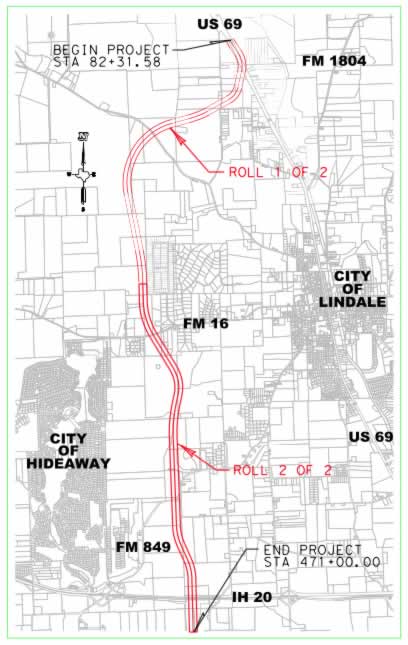
Toll 49 already connects to Interstate Highway I-20, just west of Lindale.
A $68.7 million contract was awarded on March 1, 2016 to Webber, LLC to build Segment 4, from north of I-20 to an intersection with U.S. 69 north of Lindale. Groundbreaking for the Lindale Relief Route was held on August 18, 2016. The Lindale Relief Route was opened on November 7, 2018.
This section, known as the "Lindale Relief Route," opened in 2018. The entire segment was estimated to cost $126 million including right of way acquisition, design, environmental permitting, construction and wetland mitigation. This segment includes an exit at Highway FM16.
To the east, from the Whitehouse area, Toll 49 will connect with US 271 or I-20 at a point still under discussion, near or east of the Smith-Gregg County line. From that point it will connect with other segments of the "East Texas Hourglass" to the Longview and Marshall metro areas.
Toll 49 Management and Funding Mechanisms
Toll Loop 49 is being built by the North East Texas Regional Mobility Authority (NET RMA), an independent government agency created to accelerate the development of transportation projects in North East Texas. The NET RMA is governed by a 19-member board of directors that represent each of the member counties. It was established as the 5th RMA in Texas in October 28, 2004 by the Texas Transportation Commission.
Visit the official NETRMA Toll 49 website
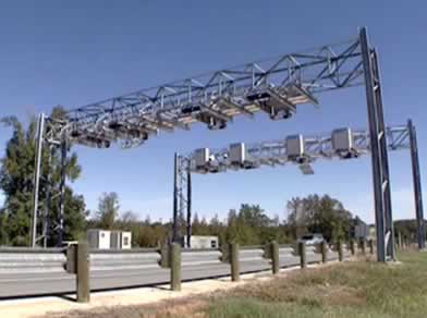 Automated toll collection system on Toll 49 in Tyler |
The loop is being paid by innovative funding mechanisms, funded by tolls, and will allow completion of the loop 15-20 years earlier than if the road had been traditionally funded.
Toll Collections on Loop 49
Like other new toll roads in Texas, Toll 49 uses state-of-the-art technology and unmanned toll stations that allow drivers to pay tolls electronically, without having to stop.
Toll 49 recognizes TxTag in addition to the Dallas area TollTag and the Houston area EZ TAG.
If a vehicle does not have an electronic toll tag, a bill for the toll charges is mailed to the vehicle owner via the "Pay by Mail" system.
Visit the hctra.org website for more information on toll tags
Texas Toll 49 Segments and Construction Status
Today, in 2025, six segments of the Texas Toll 49 are completed, and other segments are in the conceptual planning stage. A total of 32 miles are now open between State Highway 110 East near Whitehouse and U.S. 69 north of Lindale. Shown below is a recap of the status of Toll 49 Segments:
Segment |
Miles |
Location |
Status |
1 |
5.0 |
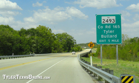
Highway 155 to Old Jacksonville Highway (FM 2493) to U.S. 69 | Opened August 2006 |
2 |
2.0 |
U.S. 69 to Paluxy Drive (FM 756) | Opened January 2008 |
3A |
5.9 |
Highway 155 to Highway 31 West | Opened 11/09/2012 |
3B |
10.4 |
Highway 31 West to I-20 |
Opened 03/28/2013 |
4 |
6.6 |
I-20 to U.S. 69 north of Lindale: The Lindale Relief Route |
Opened 11/7/2018 |
5 |
2.5 |
Paluxy Drive (FM 756) to Highway 110 (Troup Highway) | Opened 06/28/2012 |
6 |
Highway 110 (Troup Highway) to US271 / I-20 near or east of the Smith-Gregg County line | Conceptual | |
6A |
Branch off Segment 6 to I-20 near the US271/Hwy 155 area forming the east side of the outer Tyler loop | Conceptual | |
7 |
I-20 to U.S. 259 north of Longview | Conceptual | |
8 |
U.S. 259 north of Longview to U.S. 59 north of Marshall | Conceptual | |
8A |
Branch off Segment 8 forming the east side of an outer Longview loop to I-20 | Conceptual |
For more details and status, visit the official NETRMA/Toll 49 website.
Toll 49 Map Showing Segments Around Tyler
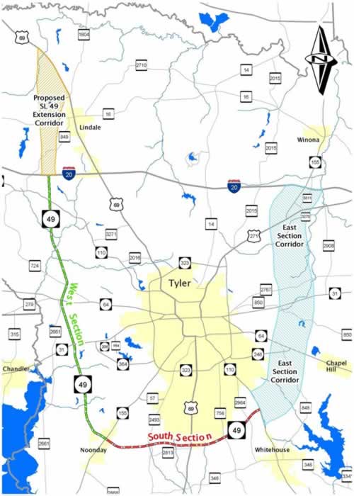 Map of Toll Loop 49 Segments around Tyler including the proposed East Section Corridor (Segment 6A) (Courtesy of the TxDOT) |
Toll 49 Lindale Relief Map
|
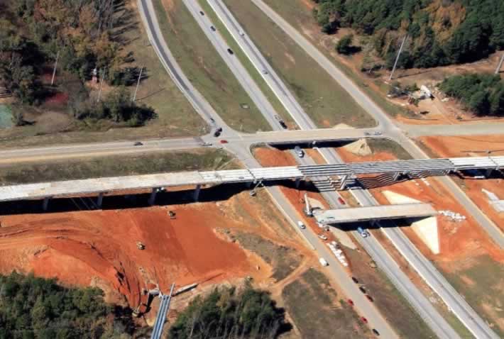 Aerial view of construction of the Toll 49 and Interstate 20 interchange, seen in 2017 (Photo courtesy of NETRMA) |
East Texas Hourglass: Network of Tollways and Freeways
Toll 49 is the first part of the "East Texas Hourglass", a major network of tollways and freeways designed to ease congestion and provide faster connections between the East Texas cities of Tyler, Longview, Kilgore, and Marshall.
Shown below is a preliminary map of the Hourglass; contact NETRMA for the current conceptual map as final routes are still under discussion.
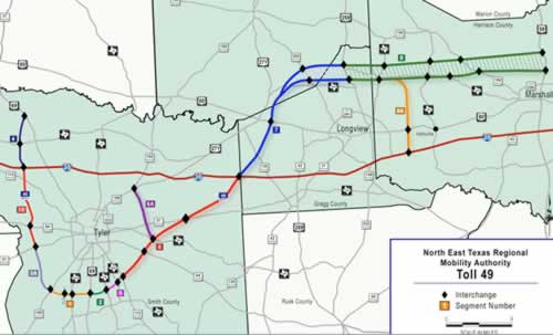 Preliminary drawing showing the general route for Toll 49 towards Longview and Marshall including segments 6, 6A, 7, 8 and 8A (Courtesy of the NETRMA) |
Texas Toll Loop 49 Photographs
 Completed overpass on Toll Loop 49 Segment 1 near Old Jacksonville Highway in Tyler (TylerTexasOnline Staff photo) |
 Close-up of Tyler rose logo on Toll 49 overpass in Tyler (TylerTexasOnline Staff photo) |
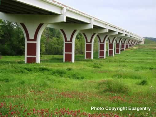 Overpass on Toll Loop 49 near Old Jacksonville Highway with wildflowers in bloom (TylerTexasOnline Staff photo) |
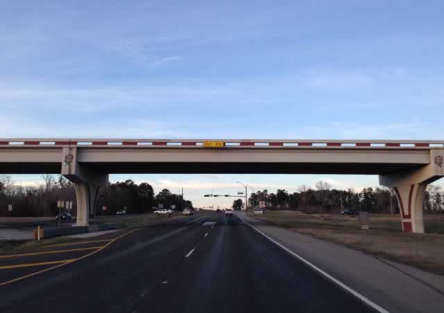 Toll 49 overpass at South Broadway Avenue in Tyler, looking north (TylerTexasOnline Staff photo) |
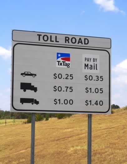 Toll Road Loop 49 toll rates sign in Tyler NOTE: Rates change over time |
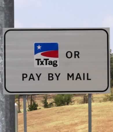 Pay by toll tag or pay by mail on Toll Loop 49, Tyler, Texas |
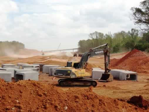 Construction of Toll 49 Segment 5 at Paluxy Drive (September 2011) (TylerTexasOnline Staff photo) |
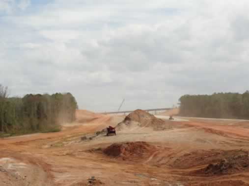 Construction of Toll Loop 49 Segment 5 at Paluxy Drive (September 2011) (TylerTexasOnline Staff photo) |
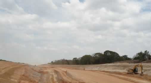 Construction of Toll Loop 49 Segment 3A west of Highway 155 (September 2011) (TylerTexasOnline Staff photo) |
Highway Infrastructure in and Around Tyler Texas
 Texas Interstate 20 Welcome Center near Wascom |
Interstate Highway I-20 is a short 15 minute drive from downtown Tyler via U.S. 69 or U.S. 271, or from other parts of Tyler via Toll Loop 49.
U.S. Highway 69 (Broadway Avenue) is the major north-south route through the city. U.S. Highway 271 heads northeast from Tyler to its intersection with I-20, and then heads to Gladewater.
Texas Highway 31 is a major east-west corridor, to Kilgore and Athens. Highways 64 and 110 are also major routes in and out of Tyler, providing a more northwest-southeast alignment.
Loop 323 functions as a ground-level 4-6 lane inner-loop, while the new Toll Loop 49 is evolving into a large outer-loop.
Important Tyler area transportation links
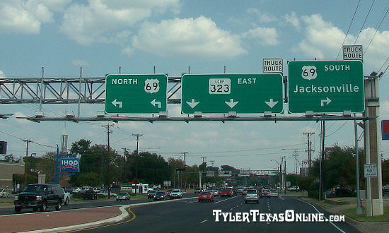
Loop 323 at its intersection with U.S. 69 in TylerNorth East Texas Regional Mobility Authority (NET RMA)
hctra.org website for toll tag information
